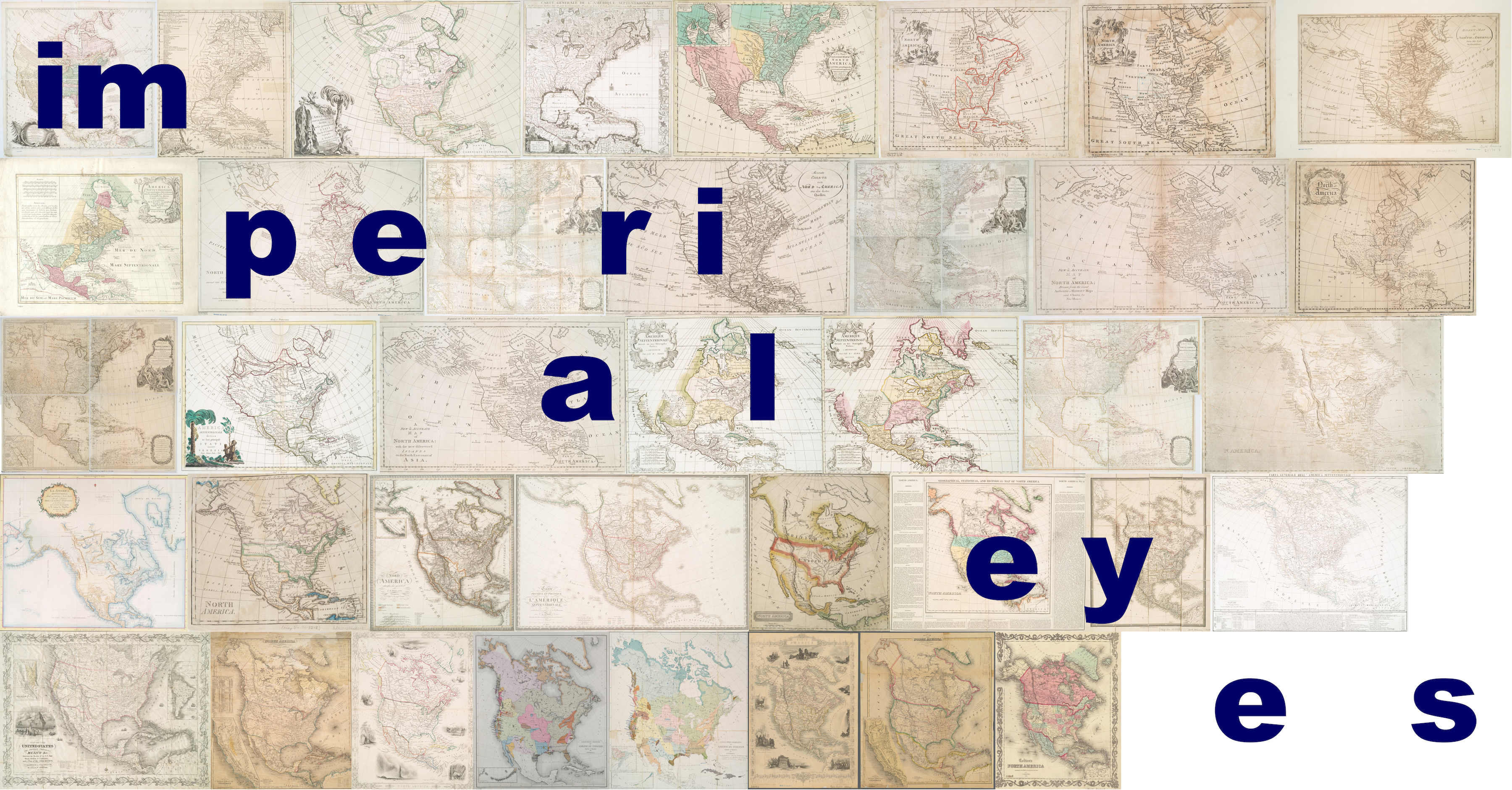
Imperial Eyes uses digital tools to engage with the ideological, physical and geographic creation of the United States. Through a side-by-side visual analysis of historical maps, and a textual analysis of land acquisition treaties, we ask: how did the acquisition and theft of land by European colonizers influence the way the continent was conceived, envisioned and mapped?
What can the visual qualities of maps tell us about the role cartography plays in the larger development of colonization?
Additionally, using digital tools to draw out deep, hard-to-decipher patterns, we attempt to answer questions about how government treaties helped shape the way land and space were visualized by early American cartographers.
By creating a navigable timeline of maps and treaties, we hope to offer a deeper understanding of the way space is visualized in relation to political circumstances and cultural assumptions.
____________________________________________________________________
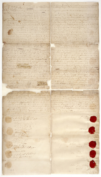
The image to the right of this text is the Treaty with the Delaware, 1778. The original document was digitized by the National Archives and is in the Public Domain.
As information studies graduate students and future librarians or archivists, we are deeply interested in executing projects predicated upon collaboration, accessibility and transparency.
All of the textual data and digital images featured within Imperial Eyes are in the public domain. This was an intentional choice so that the future of this project is neither owned or controlled by us specifically, nor will it be negatively impacted by intellectual property laws. The map components of our project, in terms of actual .jpg and .tif files as well as .xml metadata, come from the New York Public Library’s “Maps of North America” Digital Collection. The text-based treaty elements of this project come from Yale Law School's "Avalon Project: Documents in Law, History and Diplomacy." The online text was transcribed from the multiple volumes of Charles Joseph Kappler's Indian Affairs: Laws and Treaties, a bound collection of United States governmental laws and treaties with Indigenous nations that stem from the beginning of this country. Images for our treaties are a combination of digitized pages from Kappler's text and actual digital scans of original treaties, gathered from online digital collections and exhibits by the National Archives, University of Wisconsin-Madison, Beaver Area Heritage Foundation, and Oklahoma State University.
We've made our .xml metadata (in MODS 3.4 schema), treaty .txt files, images and workflow information all accessible within this site's Github repository. Please feel free to download, experiment and share.
____________________________________________________________________
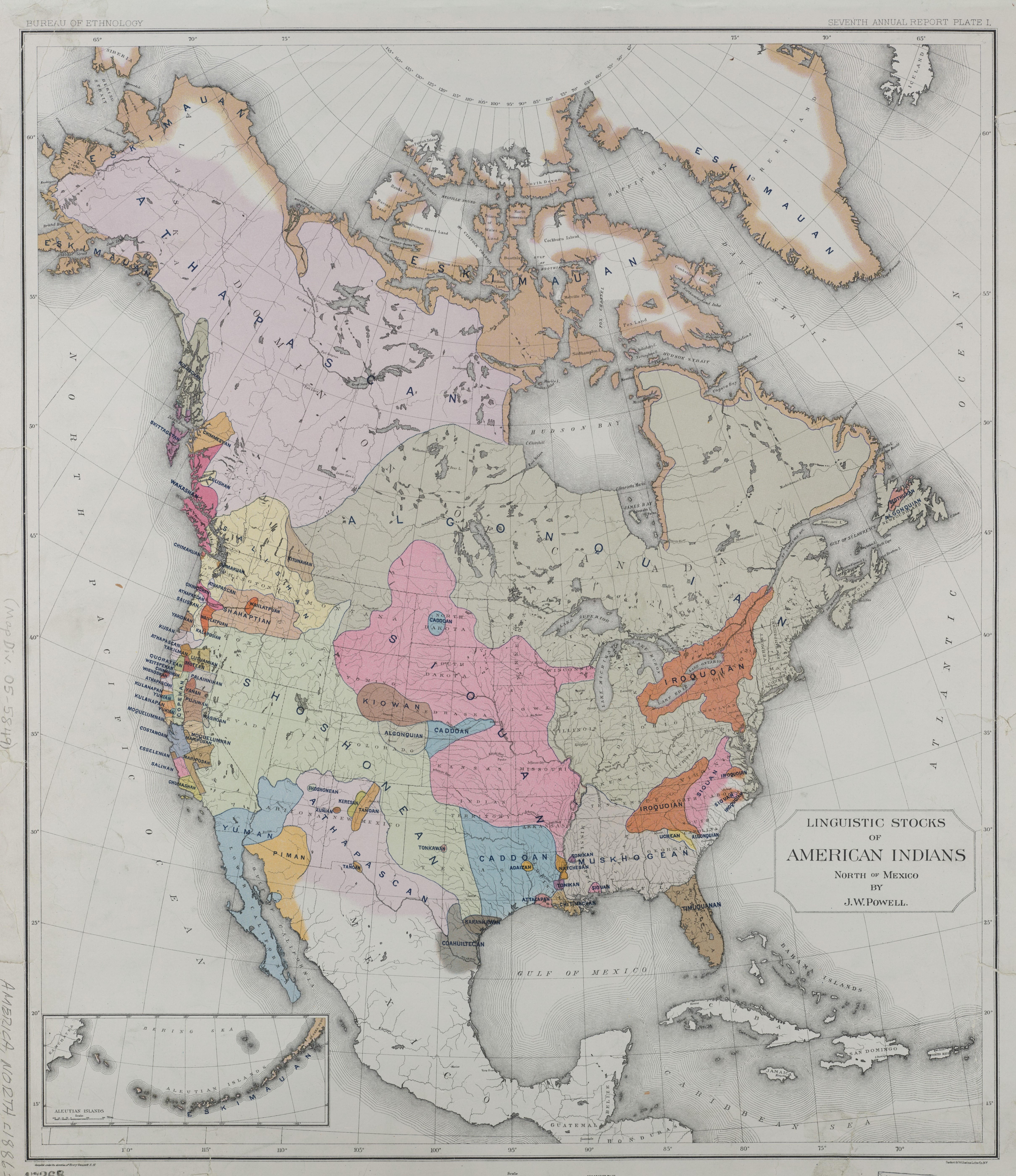
The image to the left of this text is a map titled "Linguistic stocks of American Indians north of Mexico" by cartographer John Wesley Powell (1834-1902) and lithography by Sackett & Wilhelms Litho and Print Company. It was originally issued in 1891. The original document was digitized by The New York Public Library Digital Collections and is in the Public Domain.
____________________________________________________________________
